The latest release adds over one million new parish records.
New Colour Tithe Maps for Surrey in partnership with Surrey History Center
New Colour Tithe Maps for Westmorland in partnership with The National Archives
Parish RecordsWith over 2.5 million Essex Parish Records their latest release makes TheGenealogist the place to go for Essex Research.
The launch of 900,000 new Essex Parish Records transcripts brings the total coverage for that county to over 2.5 million individuals. Spanning the period from 1512 to 2005
These records with our BMDs and Census allow family historians to research ancestors from this eastern part of England with ease.
Also released are over 158,000 Worcestershire Parish Records, bringing Worcestershire’s coverage to over 2 million individuals
Colour Tithe Maps
TheGenealogist.co.uk in conjunction with the Surrey History Centre, has launched the Surrey Colour Tithe Maps.Westmorland Colour Tithe Maps are published in partnership with The National Archives and is just one of the many counties to be conserved and digitised by TheGenealogist. Many more will be published in the forthcoming months.
These releases bring the addition of wonderfully detailed colour tithe maps to complement the online collection of tithe schedules and greyscale maps that have already been so well received by family historians researching where their ancestors lived.
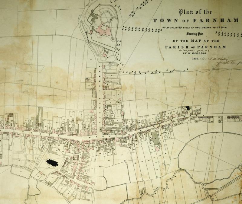
This rich store of land occupation and usage records were created in a massive survey of England and Wales from between 1836 and the early 1850s.
In these early years of the Victorian period, at a time when people were moving from the countryside to the towns, many of the urban areas that we see today as part of cities and towns can be found mapped out as tithable plots. This includes some parts of London and other big cities where cottages and gardens are plotted in the same way as fields and woods are in the countryside.
Farnham Tithe Map
These records are made available online by TheGenealogist in a partnership with The National Archives and several County Record Offices.
Brief History of Tithes
Tithes were an amount of produce given to the church, originally a tenth, then finally it became a tax on the income from the land. This was paid to the Church of England and to some lay people who owned the rights that had previously been due to the dissolved monasteries. In 1866 the majority of England and Wales was still paying what the government recognised was a discredited tax. Before they could legislate, however, they first had to collect details of what people paid - and so all the owners and occupiers of land subject to tithes were recorded and thus this fantastic resource was created.
To check out these new records head over to www.thegenealogist.co.uk