New Lloyd George Domesday Records and Maps released for Tower Hamlets
TheGenealogist has just released the Lloyd George Domesday Survey records for Tower Hamlets which cover land owners and occupiers in 1910-1915 with over 91,500 individuals recorded. These now join the previously released data books and their detailed associated maps for other parts of London, bringing the total number to nearly half a million individuals within this record set.
This new release is the latest phase of TheGenealogist’s extensive ongoing project to digitise over 94,500 Field Books, each having hundreds of pages, and linking them to large scale IR121 annotated OS maps which are now viewable in TheGenealogist’s powerful Map Explorer tool.
The records, which are sourced from The National Archives, were originally compiled by the Valuation Office in a period that stretched from 1910-1915 in response to Lloyd George’s government passing the People’s Budget 1909/1910.
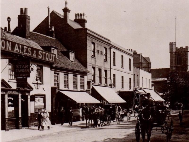
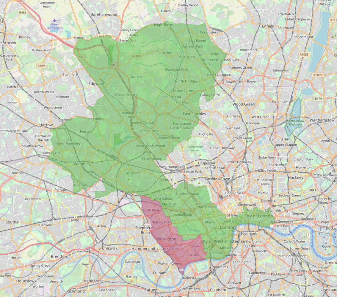
This new release covers records made of property ownership and occupation in Bethnal Green East, Bethnal Green North, Bethnal Green South, Bethnal Green West, Bow, Bromley, Christchurch, Limehouse, Mile End Centre, Mile End East, Mile End New Town, Mile End North, Mile End South West, Norton Folgate, Old Artillery Ground, Poplar North, Poplar South, Ratcliff, Saint Botolph without Aldgate, Saint George in the East, Shadwell, Wapping and Whitechapel.
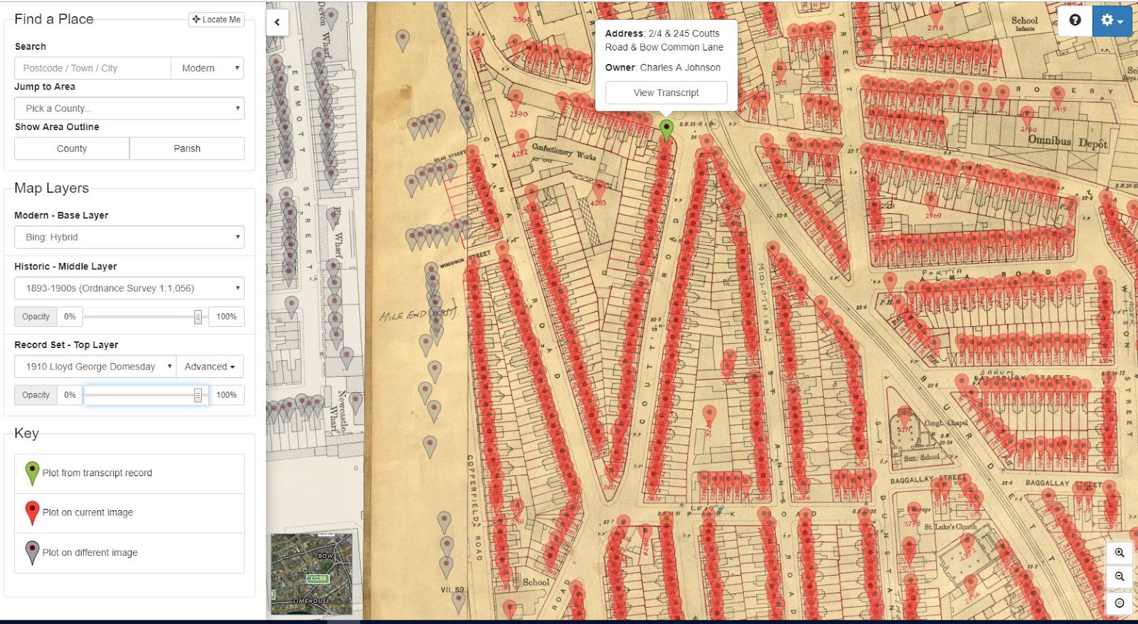
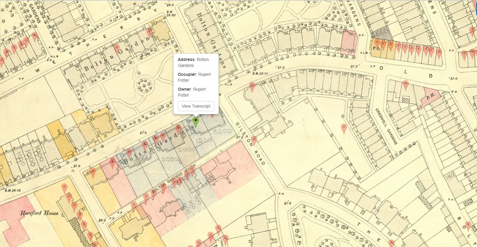
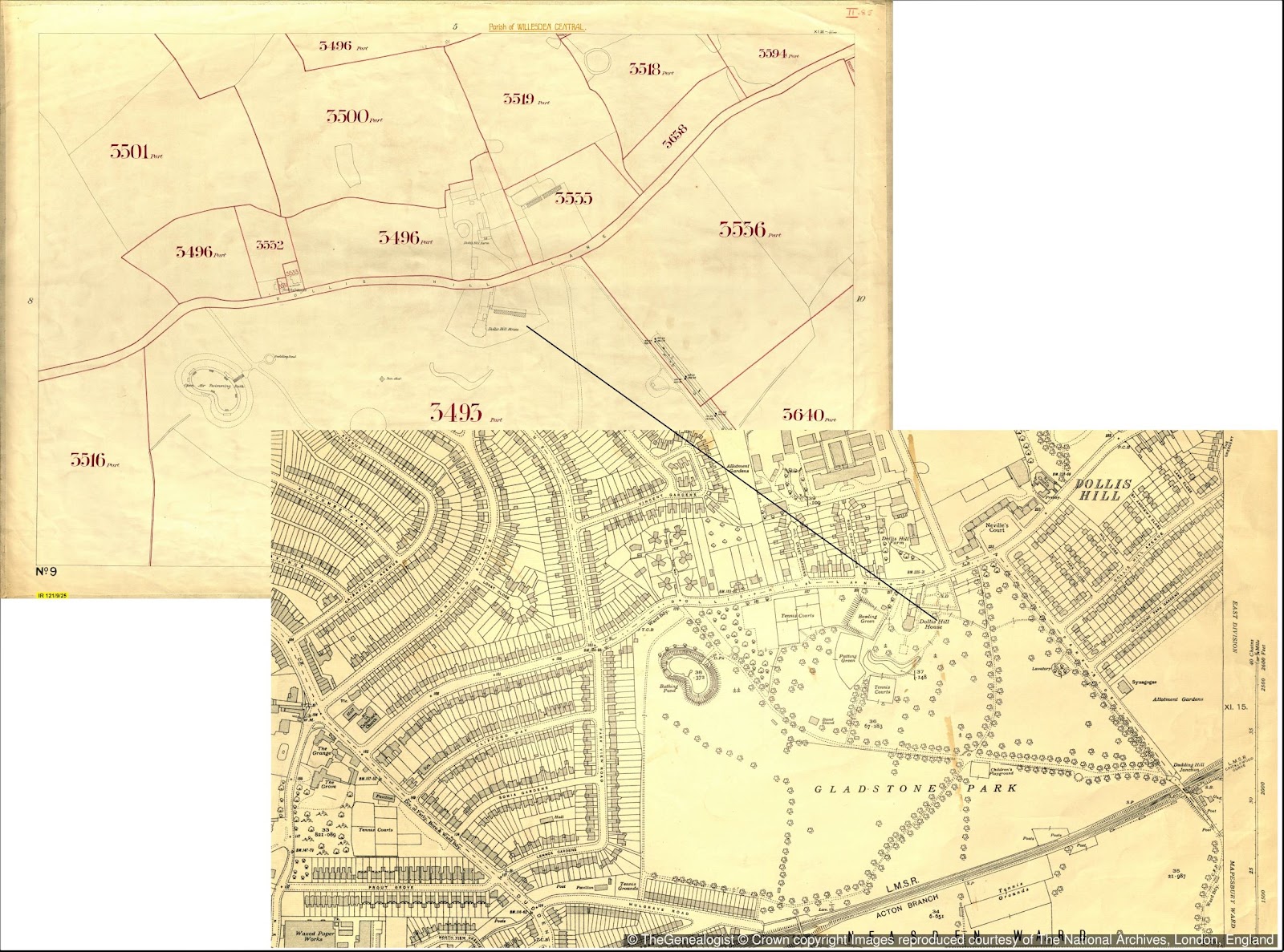
Coutts Lane identified by TheGenealogist’s map explorer showing the plot on Lloyd George Domesday map
Family historians can use these records to:
- Find ancestors who owned or occupied property in the Tower Hamlets area of London
- See the outlines of their houses on large scale maps from the time
- Fade between historic and modern maps to see how the environment has changed
- Check details of properties in the neighbourhood by clicking the red pins
- Locate an address from your research down to a specific house on the map
- Search by name, parish and street to uncover ancestors’ property in 1910-1915
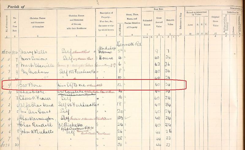
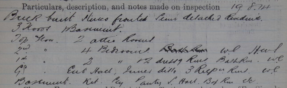
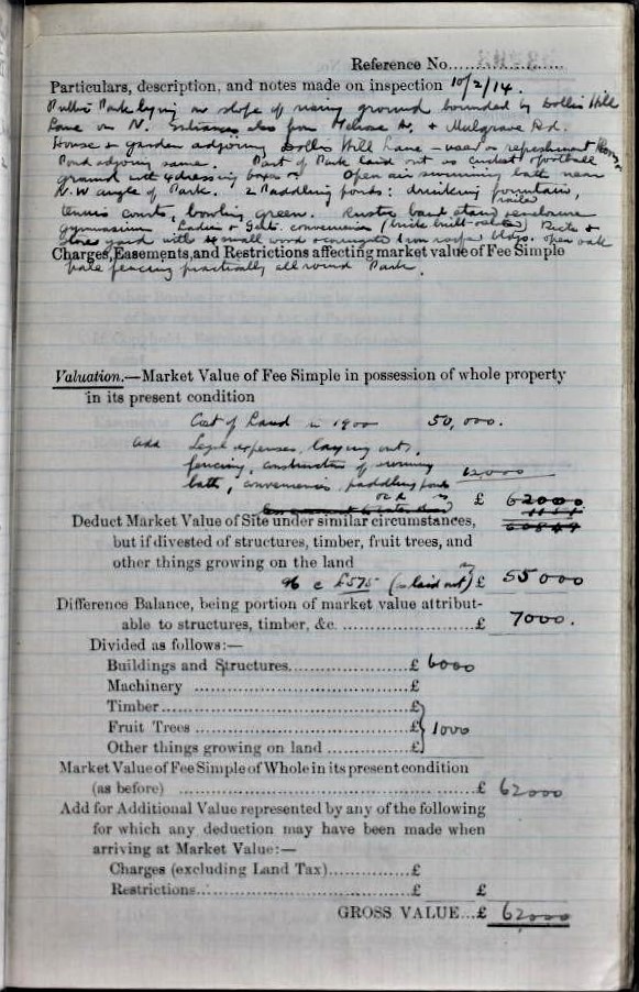
Complementing the maps on TheGenealogist’s Map Explorer are the accompanying Field Books which provide detailed information relative to the valuation of each property, including the valuation assessment number, map reference, owner, occupier, situation, description and extent.
For family historians looking for ancestors’ homes just before the First World War in the Tower Hamlets area of London this recordset is invaluable.
Read TheGenealogist’s article:
About TheGenealogist
TheGenealogist is an award-winning online family history website, who put a wealth of information at the fingertips of family historians. Their approach is to bring hard to use physical records to life online with easy to use interfaces such as their Tithe and newly released Lloyd George Domesday collections.
TheGenealogist’s innovative SmartSearch technology links records together to help you find your ancestors more easily. TheGenealogist is one of the leading providers of online family history records. Along with the standard Birth, Marriage, Death and Census records, they also have significant collections of Parish and Nonconformist records, PCC Will Records, Irish Records, Military records, Occupations, Newspaper record collections amongst many others.
TheGenealogist uses the latest technology to help you bring your family history to life. Use TheGenealogist to find your ancestors today!
About The National Archives
The National Archives is one of the world’s most valuable resources for research and an independent research organisation in its own right. As the official archive and publisher for the UK government, and England and Wales they are the guardians of some of the UK's most iconic national documents, dating back over 1,000 years. Their role is to collect and secure the future of the government record, both digital and physical, to preserve it for generations to come, and to make it as accessible and available as possible. The National Archives brings together the skills and specialisms needed to conserve some of the oldest historic documents as well as leading digital archive practices to manage and preserve government information past, present and future.
http://www.nationalarchives.gov.uk/ http://www.legislation.gov.uk/
For the latest stories, follow the Media Team on Twitter @TNAmediaofficer


.jpg)