TheGenealogist announces new Map Explorer to find ancestors' property
Press Release: Announcing Map Explorer
Powerful new map tool helps trace ancestors properties through time
TheGenealogist’s latest innovation helps you find an ancestor’s property and watch the landscape change over time. The team have georeferenced their Lloyd George Maps for Greater London which are available at launch, with further exciting developments planned for the coming months.
- TheGenealogist’s Map Explorer displays maps for different historical periods up to the modern day
- Maps are fully searchable by county, parish, street and even postcode
- Zoom down to show the individual properties as they were at the time
- Use the transparency slider to reveal a modern street map underneath
- Change the modern base map displayed to more clearly understand what the area looks like today
- Georeferenced pins link to the records for each property
- Display county or parish boundaries
- Find out more and watch the video at TheGenealogist.co.uk/maps/
The powerful Map Explorer has been developed to view these georeferenced historic maps overlaid on top of modern background maps including those from Ordnance Survey and Bing Street maps, as well as a satellite view, letting you see where your ancestor's house is today.
To complement the launch of the new Map Explorer, TheGenealogist has also released historic Ordnance Survey maps covering England, Scotland and Wales between the 1890’s and 1960’s. These have also been georeferenced, allowing you to see how the landscape changed over time.
These maps have been divided up into 3 types of layer that can be viewed on top of each other like sheets of paper - you can then change the transparency of a layer to view the layers below.
The Base Layer
This is the modern layer, which can be used to select a modern OS Map, Open Street Map or a Bing Satellite Image.
The Historic Layer
The historic layer can be used to select a range of OS maps from the 1890’s to the 1960’s
Record Set Layer
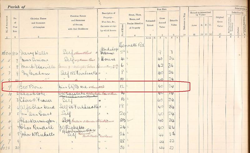
This layer provides access to map record sets such as the Lloyd George Domesday, or the soon to be launched Georeferenced Tithe Maps. Keep an eye out as further record sets are added to this layer in the future. This layer also has the ability to show “Pins”, these are map markers that link directly to the records so you can see who was living in a particular property.
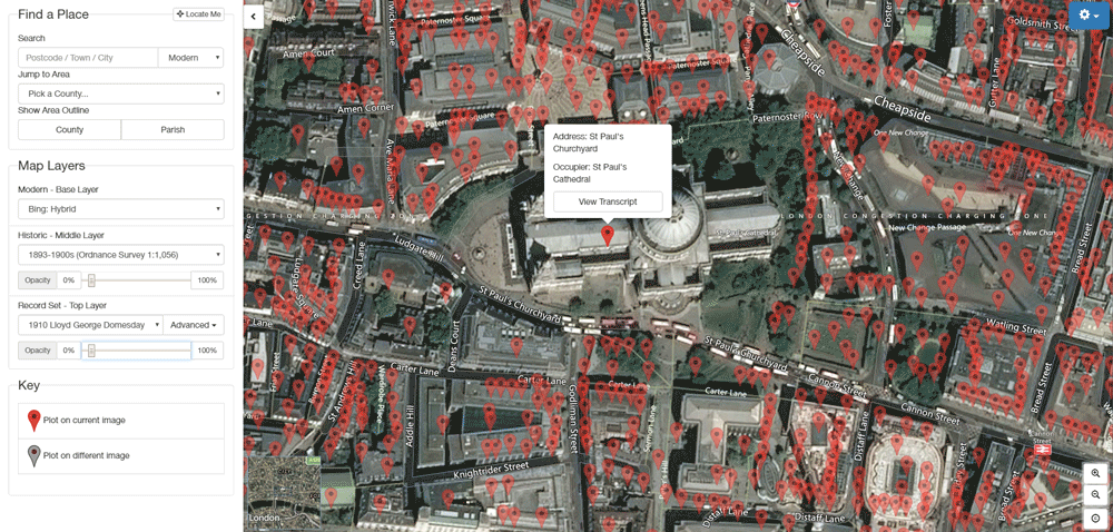
[The new Map Explorer from TheGenealogist, going from a historic map to satellite view]
The new Map Explorer has several tools to aid researchers, such as the “Place Search”. This allows you to enter a postcode or address (either Modern or Historic) and jump to that location on the maps.
Further tools let you see county and parish boundaries and even historic “Wards”, which were the areas that the Lloyd George Domesday Survey were divided into.
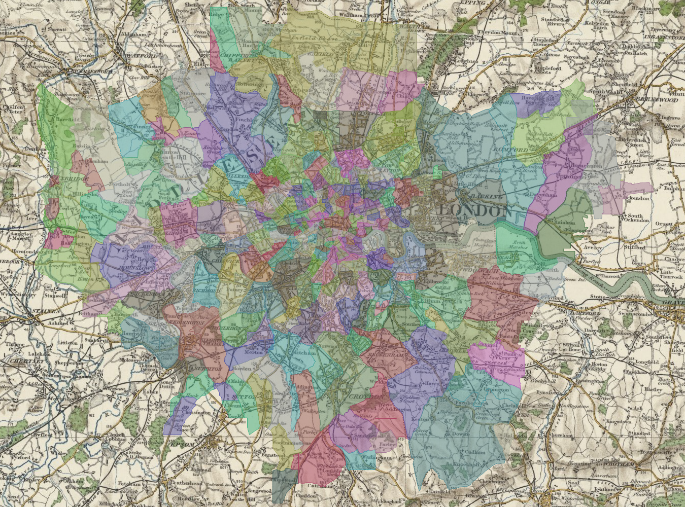
[Map showing coverage now available for Lloyd George Domesday Maps]
Researchers are now able to view Lloyd George Domesday Maps for the Greater London Area (Survey books for this area are being released ward by ward over the coming months).
Now you can pinpoint properties old and new with TheGenealogist’s Map Explorer.
Find out more and watch the video at TheGenealogist.co.uk/maps/
About TheGenealogist
TheGenealogist is an award-winning online family history website, who put a wealth of information at the fingertips of family historians. Their approach is to bring hard to use physical records to life online with easy to use interfaces such as their Tithe and newly released Lloyd George Domesday collections.
TheGenealogist’s innovative SmartSearch technology links records together to help you find your ancestors more easily. TheGenealogist is one of the leading providers of online family history records. Along with the standard Birth, Marriage, Death and Census records, they also have significant collections of Parish and Nonconformist records, PCC Will Records, Irish Records, Military records, Occupations, Newspaper record collections amongst many others.
TheGenealogist uses the latest technology to help you bring your family history to life. Use TheGenealogist to find your ancestors today!