Welcome to the Family History Social

The very latest news from the world of genealogy

Categories

More...

More than 355 Sq Miles of additional Lloyd George Domesday records released


TheGenealogist has once again expanded its Landowner and Occupier Collection with the release of over 134,000 new Lloyd George Domesday land tax records. This latest addition covers more than 355 square miles of Hertfordshire and Bedfordshire, including areas around Watford, St Albans, and Hemel Hempstead, and extending up to Luton, Dunstable, and Toddington. The records provide a fascinating insight into the lives of our ancestors, enabling researchers to uncover the owners and occupiers of properties between 1910 and 1915, as well as details about the size, state of repair, and value of their homes.


The Corn Exchange, Luton


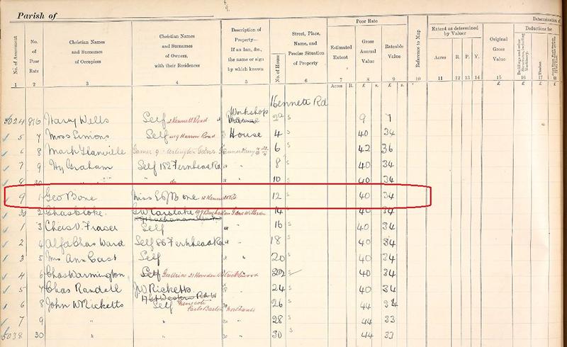
The scanned field book pages (IR58) have been meticulously linked to large scale Ordnance Survey maps from the time and are fully searchable by a person's name, county, parish, and street. TheGenealogist's powerful Map Explorer™ tool provides an easy way to switch between georeferenced modern and historical maps, allowing researchers to explore the area and see how it has changed over time.


  • Individual property details can be found in these IR58 1910 Valuation Office records
  • Fully searchable records by a person’s name, county, parish and street
  • Survey books are linked to large scale maps used in 1910-1915 and viewable on the powerful Map Explorer™ 
  • The historic OS maps locate individual plots georeferenced to a modern street map or satellite map underlay

Area covered by this release of Lloyd George Domesday Records


Included in this release are the IR58 property records for the following areas:


Abbots Langley, Aldbury, Aldenham, Barton, Berkhamsted Rural, Berkhamsted Urban, Billington, Bovingdon, Bushey and Oxhey, Caddington, Chalgrave, Dunstable, Eaton Bray, Eggington, Flamstead, Flaunden, Great Gaddesden, Harpenden, Heath and Reach, Hemel Hempstead, Houghton Regis, Hyde, Kensworth, Kings Langley, Leighton Buzzard, Linslade and Soulbury, Little Gaddesden, Luton, Markyate, Nettleden, Northchurch, Puttenham (Tring Rural), Puttenham (Tring Urban), Redbourn, Rickmansworth and Chorleywood, Ridge, Sarratt, St. Albans, St. Michael, Stanbridge, Streatley, Studham, Sundon, Tilsworth, Toddington, Totternhoe, Tring Urban, Tring Urban (Tring Rural), Watford and Wigginton.


Read TheGenealogist’s article: The “seeds” of the Ryder Cup in Land records for Hertfordshire and Bedfordshire

https://www.thegenealogist.co.uk/featuredarticles/2023/the-seeds-of-the-ryder-cup-in-land-tax-records-for-hertfordshire-1668/ 


About TheGenealogist

TheGenealogist is an award-winning online family history website, who put a wealth of information at the fingertips of family historians. Their approach is to bring hard to use physical records to life online with easy to use interfaces such as their Tithe and newly released Lloyd George Domesday collections. 

TheGenealogist’s innovative SmartSearch technology links records together to help you find your ancestors more easily. TheGenealogist is one of the leading providers of online family history records. Along with the standard Birth, Marriage, Death and Census records, they also have significant collections of Parish and Nonconformist records, PCC Will Records, Irish Records, Military records, Occupations, Newspaper record collections amongst many others.

TheGenealogist uses the latest technology to help you bring your family history to life. Use TheGenealogist to find your ancestors today!

Leave a comment

New: Pinpoint your ancestors home from the 1911 census on a map from the time

Travel back in time and locate an ancestor’s address from the 1911 England and Wales census using contemporary and georeferenced maps on TheGenealogist.co.uk’s Map Explorer™.


1911 census records identified on TheGenealogist’s Map Explorer™ 


This groundbreaking feature allows you to pin down your ancestors to properties on a contemporary map at the time of the census in 1911. With this feature family historians are able to walk the streets where their ancestors lived as not only can it be accessed on a computer but also on the move on a mobile phone!


This is an invaluable tool for house historians making it easier than ever to link census records to properties and complementing the already rich georeferenced Lloyd George Domesday Survey and Tithe records that are already available on TheGenealogist’s Map Explorer™. 


For the first time the properties recorded in the 1911 census can now be matched with georeferenced mapping to show where our English or Welsh ancestors had lived at the time of the census taken on the night of the 2nd April 1911. The majority of London can be seen all the way down to property level, while the rest of the country will identify down to the parish, road or street.


With this new release, viewing a household record from the 1911 census will now show a map, pinpointing your ancestors house. Clicking this map loads the location in Map Explorer™, enabling you to explore the area and see the records of neighbouring properties.


Discover the neighbourhoods in which your ancestors lived, and gain an insight into their lives from local churches to employment prospects in the area and the roads, rail or water links that were available. 


Read TheGenealogist’s article: Where did they live? – Mapping Your Ancestors home in 1911: https://www.thegenealogist.co.uk/featuredarticles/2021/where-did-they-live--mapping-your-ancestors-home-in-1911-1513/ 


Leave a comment

TheGenealogist reaches over 1 million 1910s Property Records

TheGenealogist reaches over 1 million 1910s Property Records

TheGenealogist has now added a total of over 1 million individuals to its unique Lloyd George Domesday Survey recordset with the addition this week of 85,959 individuals from the 1910s property tax records for the Borough of Haringey. Covering the areas of Hornsey Central, Hornsey East, Hornsey West, as well as Tottenham A, Tottenham B, Tottenham C and Wood Green this week’s release is made up of maps and field books that name property owners and occupiers in a exclusive online resource that gives family history researchers the ability to discover where an ancestor lived in the 1910-1915 period. 


When combined with other records such as the 1911 Census, the IR58 Valuation Office records give researchers additional information about their ancestors' home, land, outbuildings and property. While these records may be searched from the Master Search or main search page of TheGenealogist, they have also been added to TheGenealogist’s powerful Map Explorer so that the family historian can see how the landscape where their ancestor lived or worked changed as the years have passed.


All of the contemporary OS maps are linked to field books that reveal descriptions of the property, as well as listing the names of owners and occupiers. This release makes it possible to precisely locate where an ancestor lived on a number of large scale, hand annotated maps for this part of London. These map the exact plots of properties at the time of the survey and are layered over various georeferenced historical maps and modern base maps on the Map Explorer™. Only available online from TheGenealogist, these records enable the researcher to thoroughly investigate a place in which an ancestor lived even if the streets have undergone massive change in the intervening years. 


Read TheGenealogist’s article that finds the Tottenham cottage responsible for giving the old Spurs football ground its popular name: https://www.thegenealogist.co.uk/featuredarticles/2021/haringey-land-valuation-records-uncovers-the-modest-house-that-gave-its-name-to-a-famous-football-stadium-1429/


About TheGenealogist

TheGenealogist is an award-winning online family history website, who put a wealth of information at the fingertips of family historians. Their approach is to bring hard to use physical records to life online with easy to use interfaces such as their Tithe and newly released Lloyd George Domesday collections. 

TheGenealogist’s innovative SmartSearch technology links records together to help you find your ancestors more easily. TheGenealogist is one of the leading providers of online family history records. Along with the standard Birth, Marriage, Death and Census records, they also have significant collections of Parish and Nonconformist records, PCC Will Records, Irish Records, Military records, Occupations, Newspaper record collections amongst many others.

TheGenealogist uses the latest technology to help you bring your family history to life. Use TheGenealogist to find your ancestors today!

Leave a comment

Hounslow Lloyd George Domesday records added to TheGenealogist’s Map Explorer™


TheGenealogist has just released the records of over 33,000 individuals for the Hounslow area into its property ownership and occupancy record set: The Lloyd George Domesday Survey. This is a unique online resource that includes maps and field books and gives researchers the ability to discover where an ancestor lived in the 1910-1915 period. By making use of TheGenealogist’s powerful Map Explorer the researcher can see how the landscape where their ancestor lived or worked changed over time.


The maps and residential data, in The Lloyd George Domesday Survey records are sourced from The National Archives and are being digitised by TheGenealogist so that it is possible to precisely locate where an ancestor lived on large scale, hand annotated maps. These plans include plots for the exact properties and are married to various georeferenced historic map overlays and modern base maps on the Map Explorer™. With this resource the researcher is able to thoroughly investigate the area in which an ancestor lived. 


  • TheGenealogist’s Lloyd George Domesday records link individual properties to extremely detailed maps used in 1910-191
  • Fully searchable by name, county, parish and street
  • The maps will zoom down to show the individual properties as they were in the 1910s
  • The transparency slider reveals a modern street map underlay
  • Change the base map displayed to more clearly understand what the area looks like today

Hounslow records cover the areas of Bedfont, Chiswick, Cranford, Feltham, Hanworth, Heston, Isleworth, New Brentford and Old Brentford.


Read their article on finding the retreat of Georgiana, Duchess of Devonshire that became a "Lunatic Asylum" before the First World War and a Fire Station in World War 2 in these records:

https://www.thegenealogist.co.uk/featuredarticles/2020/harlow-property-records-discover-snapshot-of-owners-and-occupiers-from-edwardian-past-1290/


About TheGenealogist

TheGenealogist is an award-winning online family history website, who put a wealth of information at the fingertips of family historians. Their approach is to bring hard to use physical records to life online with easy to use interfaces such as their Tithe and newly released Lloyd George Domesday collections. 

TheGenealogist’s innovative SmartSearch technology links records together to help you find your ancestors more easily. TheGenealogist is one of the leading providers of online family history records. Along with the standard Birth, Marriage, Death and Census records, they also have significant collections of Parish and Nonconformist records, PCC Will Records, Irish Records, Military records, Occupations, Newspaper record collections amongst many others.

TheGenealogist uses the latest technology to help you bring your family history to life. Use TheGenealogist to find your ancestors today!


Leave a comment

The 1910 Lloyd George Domesday Records with annotated maps

Latest News on a Major new release: TheGenealogist has released the first part of an exciting new record set, The Lloyd George Domesday Survey - a major new release that will find where an ancestor lived in 1910. This unique combination of maps and residential data, held by The National Archives and being digitised by TheGenealogist, can precisely locate your ancestor’s house on large scale (5 feet to the mile) hand annotated maps that plots the exact property.

Image of IR91 Index book on TheGenealogist

Image of IR91 Index book 

  Complementing the maps on TheGenealogist are the accompanying books that will also provide researchers with basic information relative to the valuation of each property, including the valuation assessment number, map reference, owner, occupier, situation, description and extent. This mammoth project begins with the first release of the IR91 Index with subsequent releases of the more detailed IR58 Field Books planned. There are over 94,500 Field Books, each having hundreds of pages to digitise with associated large scale IR121 annotated OS maps. The initial release from TheGenealogist is for the City of London and Paddington maps with their index records. Future releases will expand out across the country with cross linked maps wherever they are available. Find out more at: TheGenealogist.co.uk/1910Survey/ Mark Bayley, Head of Development at TheGenealogist says: “With our English & Welsh Tithe Map collection, we’ve become known for our map based records and this new collection makes a fantastic later addition. The maps show an incredible amount of detail, allowing you to zoom right in on the hand annotated property. The records that go with these maps are just as detailed, allowing you to find out all manner of information about your ancestral home.” The National Archives issued the following statement: “The Lloyd George ‘Domesday Records’ form essentially a census of property for Edwardian England and Wales. The innovative linking of individually searchable property data with associated annotated Ordnance Survey maps will be of huge value to family and local historians alike.” To find out more about these records, you can visit our informative record collection page at:  TheGenealogist.co.uk/1910Survey/
Image source: © TheGenealogist © Crown copyright images reproduced courtesy of The National Archives, London, England
Leave a comment
Found 5 Results.
Back to top