Welcome to the Family History Social

The very latest news from the world of genealogy

Categories

More...

National Tithe Record Collection for England & Wales now complete on Map Explorer™

Pinpoint your English and Welsh Ancestors on the map

TheGenealogist has announced the completion of its project to link all the National Tithe Record Collection for England & Wales with its powerful Map Explorer™.


Family historians are now able to view their ancestors’ land and homes plotted on historic Tithe maps that have been georeferenced, allowing you to see the location on today's Modern Street and Satellite maps to see how the area has developed over time. 


Tithe record books and maps cover the majority of England and Wales and were created by the 1836 Tithe Commutation Act. This required tithes in kind to be converted to monetary payments, known as tithe rentcharges. The Tithe Survey was established to find out which areas were subject to tithes, who owned them, who occupied the various parcels of land, the usage of the land, how much was payable and to whom. These maps and apportionment books were the product of that survey and have been digitised by TheGenealogist.


Tithes usefully record all levels of society, from wealthy landowners to tenant farmers and cover the majority of England and Wales. They are a valuable resource for family and house historians as they can provide insights into land and property ownership, occupancy and usage, dating back before the first searchable census. 


TheGenealogist has painstakingly georeferenced their tithe maps, which means you can view them layered on top of modern day maps and satellite images, using their intuitive Map Explorer™. This allows you to pinpoint a record to the exact same location on various historical and modern maps, even when the landscape has completely changed over the years.

“This final release of the Welsh tithes marks the completion of our project.These records, in combination with Map Explorer, make it easier than ever to learn about our ancestors’ lives and the places they lived and worked.” Mark Bayley, Head of Online Content at TheGenealogist.

This week’s release adds to the many types of records that can be viewed in Map Explorer™. This includes the Lloyd George Domesday land tax records, the UK census 1871-1911, the 1939 Register, the Headstone Collection, War Memorials and the Image Archive.

To learn more about TheGenealogist’s powerful Map Explorer™, please visit https://www.thegenealogist.co.uk/maps/

Feature Article Case Study


Read our feature article where we use the records on Map Explorer™ to take a look at Thomas Rees, an agricultural labourer, leader of the first Rebecca Riots and, under a unique Welsh tradition, a freeholder of a cottage that he built in one night!
https://www.thegenealogist.co.uk/featuredarticles/2023/found-in-the-welsh-tithe-records-the-cottage-built-in-one-night-6801/


About TheGenealogist

TheGenealogist is an award-winning online family history website, which puts a wealth of information at the fingertips of family historians. Their approach is to bring hard to use physical records to life online with easy to use interfaces such as their Tithe and newly released Lloyd George Domesday collections. 

TheGenealogist’s innovative SmartSearch technology links records together to help you find your ancestors more easily. TheGenealogist is one of the leading providers of online family history records. Along with the standard Birth, Marriage, Death and Census records, they also have significant collections of Parish and Nonconformist records, PCC Will Records, Irish Records, Military records, Occupations and Newspaper record collections amongst many others.

TheGenealogist uses the latest technology to help you bring your family history to life. Use TheGenealogist to find your ancestors today!

Leave a comment

New Release: 1871 UK Census households now plotted on Map Explorer™

The 1871 Census for England, Scotland and Wales has, for the first time, been georeferenced on TheGenealogist. This is the process of linking a record to a geographical spot and means you can now see where a household stood with links to detailed maps on the powerful Map Explorer™. This is set to make investigating the places where ancestors lived in this year even more interesting for family and house historians. 


Viewing a household record from the 1871 census on TheGenealogist will now show a map pinpointing its location. Clicking through from this preview map opens the powerful Map Explorer™ with its georeferenced modern and historical maps. This then enables subscribers to explore their ancestors’ area in much greater detail than on other census sites.


1871 census household pinpointed on Map Explorer™ 


Joining the earlier census releases, which saw the 1911, 1901, 1891 and 1881 census linked up to the powerful mapping tool, researchers can now easily identify with just the click of a button where their forebears had once lived and get a sense of the routes their ancestors used. 


Using these linked maps allows researchers to trace the thoroughfares that ancestors may have walked down as they went shopping, or popped into their local pubs for a drink. Researchers can likewise, work out the routes that their forebears may have taken to get to their nearby churches, or find the shortest way to their places of work and the direction they needed to go in order to reach their nearby park for relaxation. Historical maps can also reveal where the nearest railway station was to their home, important for understanding how our ancestors could have travelled to other parts of the country to see relatives or to visit their hometown.


With this powerful resource, Starter, Gold and Diamond subscribers of TheGenealogist can look into their ancestors’ neighbourhood from home on their computer screens, or even access the census and the relevant maps on their mobile phone as they walk down the modern streets.


The Greater London Area, Buckinghamshire and Berkshire along with most towns and cities can be viewed down to the property level, while other parts of the country will identify down to the parish, road or street.


Albert Mansions and Albert Hall


In this particular census year, Queen Victoria opened the Royal Albert Hall, Gilbert and Sullivan premiered the first of their light opera collaborations at the Gaiety Theatre in London and a technologically advanced lighthouse was switched on near Tyne and Wear. 


Read TheGenealogist's article “Putting 1871 on the map” to discover more as Nick Thorne takes a look at events in 1871 and brings context to the census records. https://www.thegenealogist.co.uk/featuredarticles/2023/putting-1871-on-the-map-1673/ 


About TheGenealogist

TheGenealogist is an award-winning online family history website, who put a wealth of information at the fingertips of family historians. Their approach is to bring hard to use physical records to life online with easy to use interfaces such as their Tithe and newly released Lloyd George Domesday collections. 

TheGenealogist’s innovative SmartSearch technology links records together to help you find your ancestors more easily. TheGenealogist is one of the leading providers of online family history records. Along with the standard Birth, Marriage, Death and Census records, they also have significant collections of Parish and Nonconformist records, PCC Will Records, Irish Records, Military records, Occupations, Newspaper record collections amongst many others.

TheGenealogist uses the latest technology to help you bring your family history to life. Use TheGenealogist to find your ancestors today!


Leave a comment

More than 355 Sq Miles of additional Lloyd George Domesday records released


TheGenealogist has once again expanded its Landowner and Occupier Collection with the release of over 134,000 new Lloyd George Domesday land tax records. This latest addition covers more than 355 square miles of Hertfordshire and Bedfordshire, including areas around Watford, St Albans, and Hemel Hempstead, and extending up to Luton, Dunstable, and Toddington. The records provide a fascinating insight into the lives of our ancestors, enabling researchers to uncover the owners and occupiers of properties between 1910 and 1915, as well as details about the size, state of repair, and value of their homes.


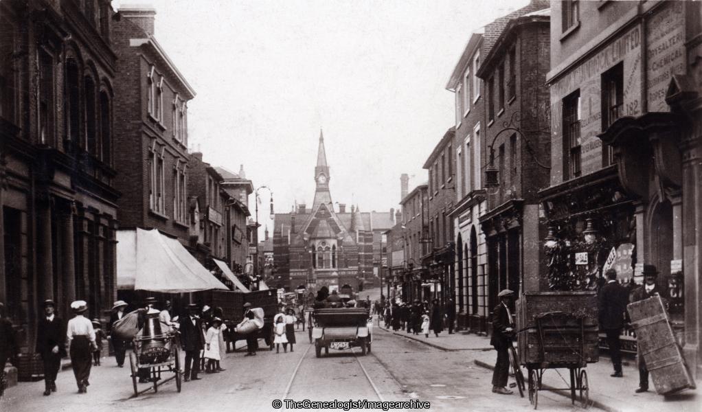
The Corn Exchange, Luton


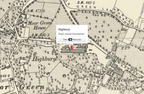
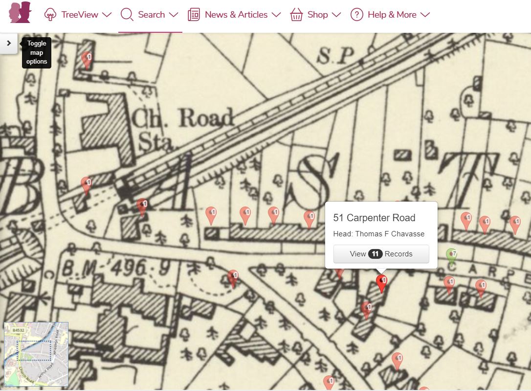
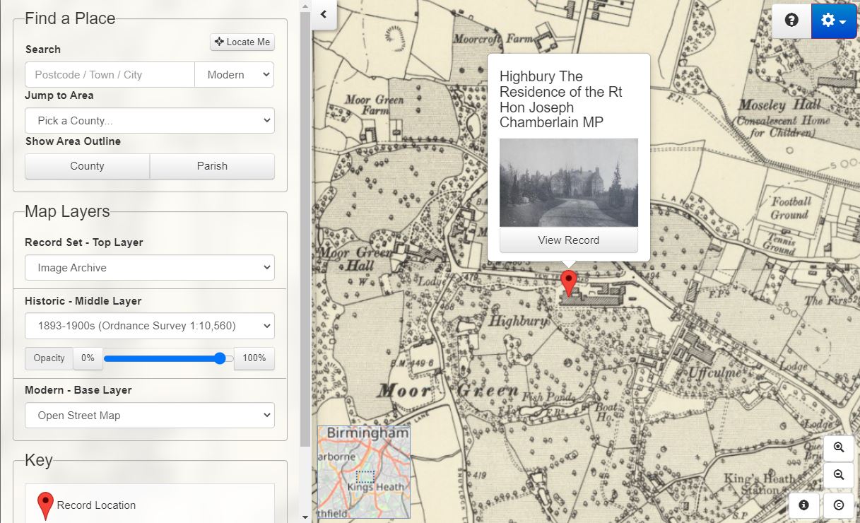
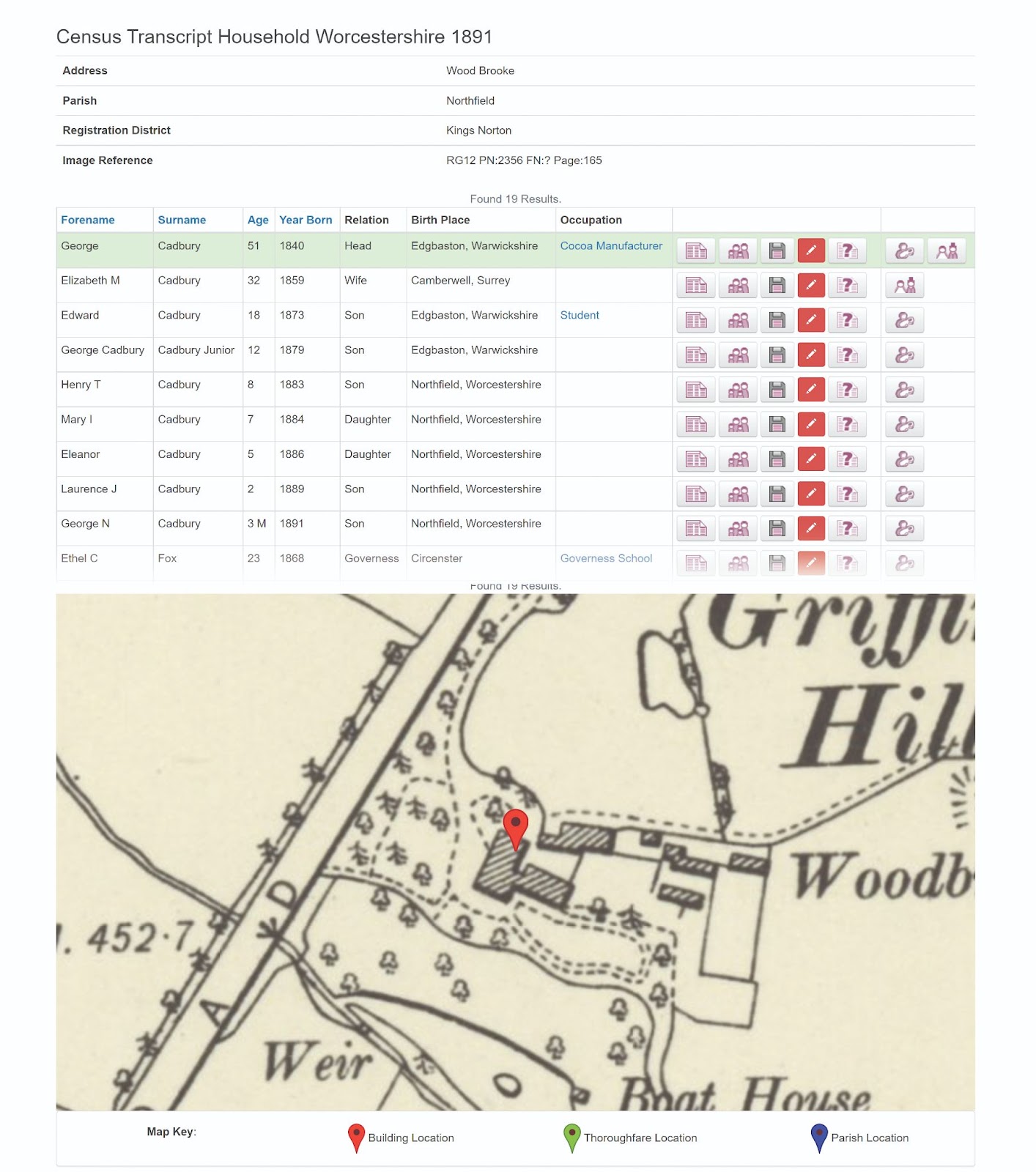
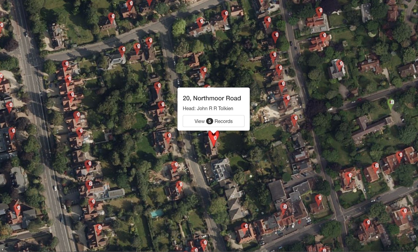
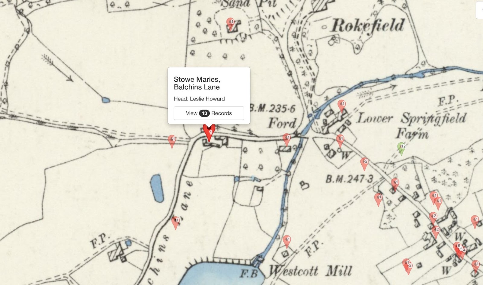
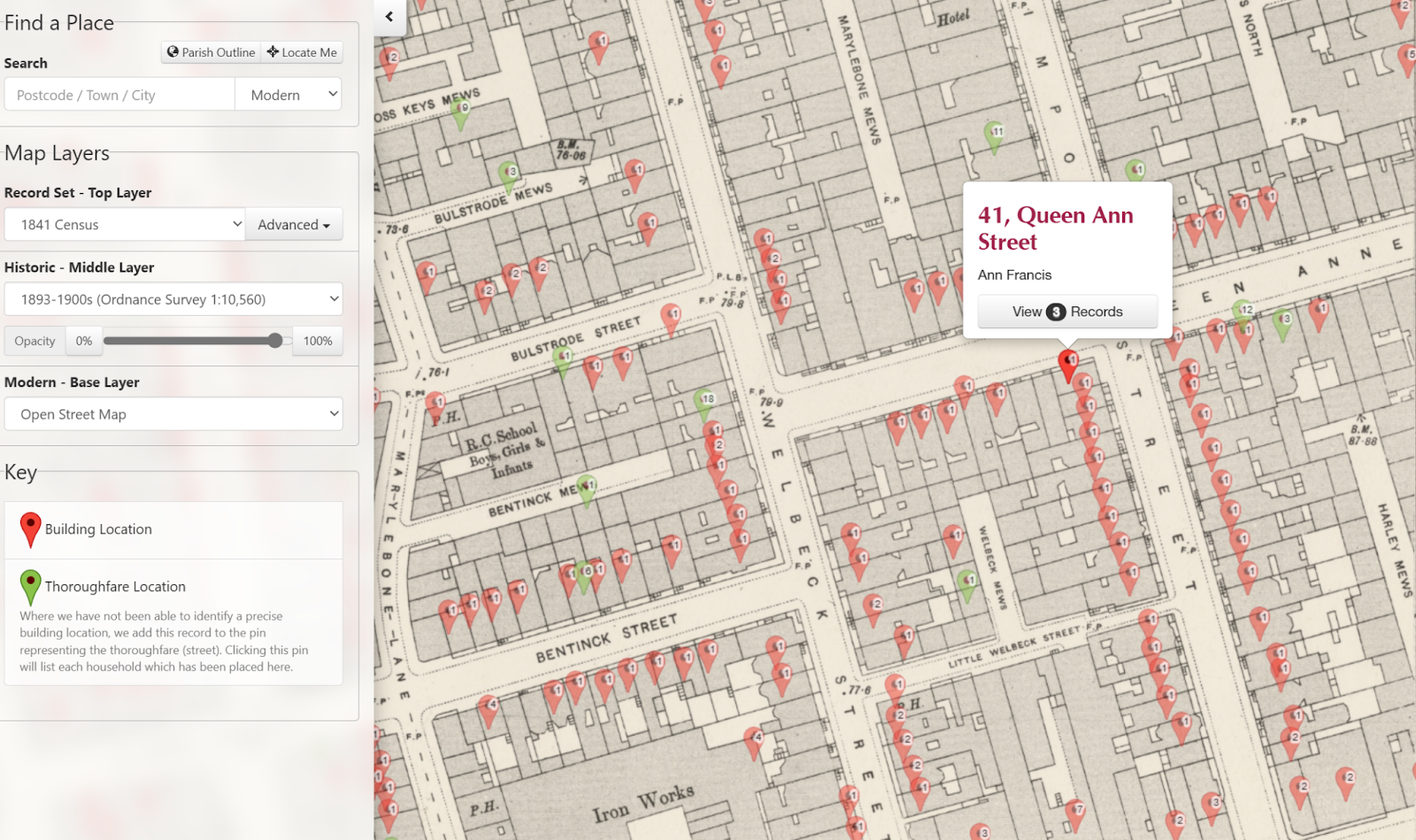
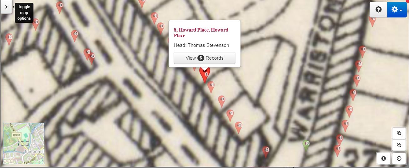
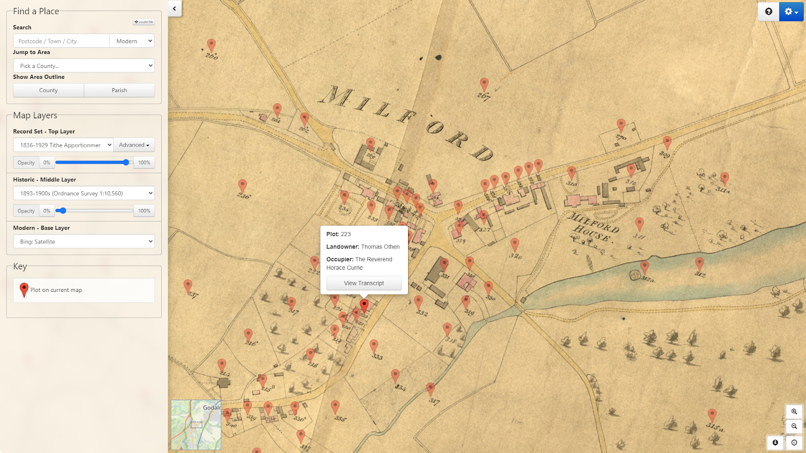
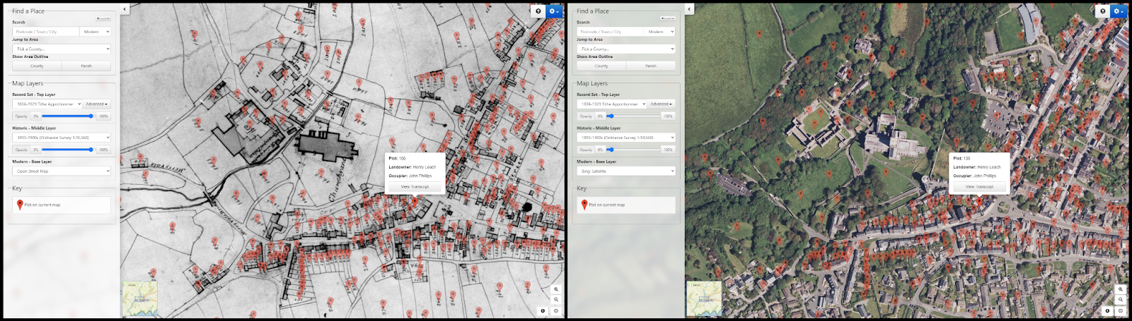
The scanned field book pages (IR58) have been meticulously linked to large scale Ordnance Survey maps from the time and are fully searchable by a person's name, county, parish, and street. TheGenealogist's powerful Map Explorer™ tool provides an easy way to switch between georeferenced modern and historical maps, allowing researchers to explore the area and see how it has changed over time.


  • Individual property details can be found in these IR58 1910 Valuation Office records
  • Fully searchable records by a person’s name, county, parish and street
  • Survey books are linked to large scale maps used in 1910-1915 and viewable on the powerful Map Explorer™ 
  • The historic OS maps locate individual plots georeferenced to a modern street map or satellite map underlay

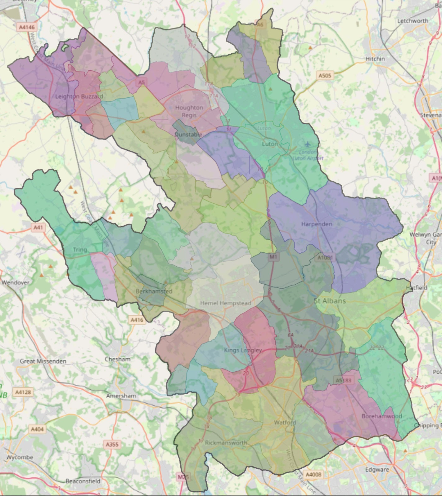
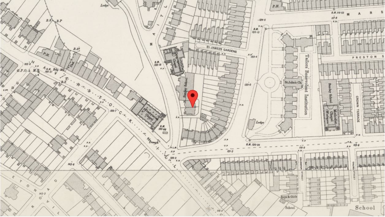
Area covered by this release of Lloyd George Domesday Records


Included in this release are the IR58 property records for the following areas:


Abbots Langley, Aldbury, Aldenham, Barton, Berkhamsted Rural, Berkhamsted Urban, Billington, Bovingdon, Bushey and Oxhey, Caddington, Chalgrave, Dunstable, Eaton Bray, Eggington, Flamstead, Flaunden, Great Gaddesden, Harpenden, Heath and Reach, Hemel Hempstead, Houghton Regis, Hyde, Kensworth, Kings Langley, Leighton Buzzard, Linslade and Soulbury, Little Gaddesden, Luton, Markyate, Nettleden, Northchurch, Puttenham (Tring Rural), Puttenham (Tring Urban), Redbourn, Rickmansworth and Chorleywood, Ridge, Sarratt, St. Albans, St. Michael, Stanbridge, Streatley, Studham, Sundon, Tilsworth, Toddington, Totternhoe, Tring Urban, Tring Urban (Tring Rural), Watford and Wigginton.


Read TheGenealogist’s article: The “seeds” of the Ryder Cup in Land records for Hertfordshire and Bedfordshire

https://www.thegenealogist.co.uk/featuredarticles/2023/the-seeds-of-the-ryder-cup-in-land-tax-records-for-hertfordshire-1668/ 


About TheGenealogist

TheGenealogist is an award-winning online family history website, who put a wealth of information at the fingertips of family historians. Their approach is to bring hard to use physical records to life online with easy to use interfaces such as their Tithe and newly released Lloyd George Domesday collections. 

TheGenealogist’s innovative SmartSearch technology links records together to help you find your ancestors more easily. TheGenealogist is one of the leading providers of online family history records. Along with the standard Birth, Marriage, Death and Census records, they also have significant collections of Parish and Nonconformist records, PCC Will Records, Irish Records, Military records, Occupations, Newspaper record collections amongst many others.

TheGenealogist uses the latest technology to help you bring your family history to life. Use TheGenealogist to find your ancestors today!

Leave a comment

Maps for family historians and using them to explore the past

Maps are one of the most important visual aids that a family, social or house historian can turn to when exploring the homes of our ancestors. We may have already come across a record that has provided us with an address, or maybe all we have is just a place name, and we want to explore the surrounding streets or the area.


Tithe map of Sedbergh, Yorkshire courtesy of The National Archives

There are various types of map resources that we can use to step back in time, get a better understanding of the landscape that our ancestors would have been living in. By seeing the environment in which they had once lived enables us to see roads, rivers and railways that can explain where they moved on to, or where they had come from in the first place. 


Another line that we may research with the use of a map is for determining employment opportunities for people who had lived in a particular place in a particular time. The map could show us employment opportunities whether they were farms, mills, mines or some type of industrial building such as factories, distilleries, breweries and so on that had attracted our ancestors to live in that place.


Colour Tithe map of the Parish of St Cuthbert in York


Maps can reveal other fascinating information that can be useful in our research, for example we can often see who the landowners were and a historical map allows us to work out the nearest church or nonconformist chapel to where our ancestors lived. With this knowledge the researcher can then look for their forebears' baptisms, marriages and burials in the relevant records connected to that church/chapel.


We can use a range of maps from modern street maps of City & Town maps to historical maps drawn up in the past. Often the problem with a modern map is that they only show us the lay of the land as it is today and not as it may have been when our forebears walked the highways and byways of the area that we are investigating. Many places have seen significant changes over the years with modern redevelopments replacing previous settlements or roads that had first been laid out in medieval times.


A useful set of maps for investigation where an early Victorian era English or Welsh ancestor may have lived are the Tithe Maps. The Tithe Survey which was responsible for the creation of the Tithe Maps was as a result of  the Tithe Commutation Act 1836 and covered a large part of the country that was still subject to tithes and had not been enclosed. These maps and their accompanying apportionment books can be used to discover where people were living and who their neighbours were in the period of the survey from 1836 to the 1850s. Three sets were made of each area, one for the parish, one for the diocese and one for the Tithe Commissioners in London. This last set is in the safekeeping of The National Archives at Kew and have been digitised and put online by commercial family history website TheGenealogist. The parish and diocese maps are likely to be at the diocesan archive which may not necessarily be the county record office for the town/area that you are researching as some ecclesiastical dioceses' boundaries included parts of neighbouring counties. Tithe maps include both owners and occupier’s names and so are useful for family historians  delving into their family history. The maps can often show details such as boundaries, roads, waterways, buildings and woodlands. Sometimes these Victorian era maps show other details such as hedges, field names, mines and factories.


What maps can I use to research my ancestors’ stories?


There have been many maps drawn up over time. Some of these maps are more useful to us than others for researching our family history, although there can be occasions we need to consult a more specialist map such as when doing a house history. A list of maps that a family, social or house historian could use can be seen at https://www.map-explorer.co.uk/

Many of these maps can be found in the local County Record Office though quite a few, but not all, are becoming available on the internet. 


One of the most useful tools for family, social and house historians is the powerful online Map Explorer™ that is accessed on the subscription website TheGenealogist. Boasting a number of georeferenced historic as well as modern maps this resource allows its users to see the plots relating to historical records, such as the Tithe Survey and then fade between the different map layers. Because the historic and modern maps are matched to the same coordinates the researcher can view where an ancestor may have once occupied a small cottage and garden, or even a large estate with many fields, woods and so on. Once found it is then easy to use this tool to see what is there today. As urban boundaries have encroached the countryside it is sometimes fascinating to see how rural what we now see as city suburbs was in our ancestors’ time. 


Map Explorer™ with its georeferenced historical and modern maps includes not only Tithe Records and Maps to look for your Victorian ancestors’ homes, but also Inland Revenue Valuation Office (Lloyd George Domesday Survey) Records and Maps for nearly one million individuals. Other useful record set layers include Census records, Headstones and War memorials and the mapping interface now also allows users the ability to also see what their ancestors’ towns and areas in the U.K. had once looked like as it now includes historical pictures. This sees the addition of period photographs of street scenes and parish churches where researchers' ancestors may have been baptised, married and buried, added to the maps as a recordset layer. The various images for an area have their locations pinpointed on the maps, allowing family historians to explore their ancestors’ hometowns and other landmarks from around their area.


Important repositories of maps include:

The National Archives

Ruskin Avenue,

Kew,

Richmond,

Surrey TW9 4DU https://www.nationalarchives.gov.uk


British Library at St. Pancras

96 Euston Road,

London NW1 2DB https://www.bl.uk/


Bodleian Library

Broad Street,

Oxford OX1 3BG https://www.bodleian.ox.ac.uk/


Leave a comment

TheGenealogist cuts the cost of pinpointing your ancestors


TheGenealogist has been praised for its innovative tools that allow you to discover exactly where your ancestors lived, using Map Explorer™. This innovative feature has now been added to Gold and Starter level subscriptions.


Home of Joseph Chamberlain (father of the WW2 prime minister) found on the 1891 census in Map Explorer™  


Census pins identify properties on Map Explorer™ 


Image Archive records located on Map Explorer™ 


From today, a significant number of databases including the 1891, 1901 and 1911 census, plus TheGenealogist’s Image Archive pictures and along with the Domesday Book 1086, are now available with pins on georeferenced maps in Map Explorer™. This makes  Starter & Gold Subscriptions powerful resources for researchers to see where their forebears lived, as well as to investigate the neighbourhood and surrounding area. Accessing Map Explorer™ on a mobile allows researchers to walk in the footsteps of ancestors and discover where homes, schools, places of work and other buildings may once have stood but have now disappeared. 


This interface will place a pin on the house using historical data to identify its location where possible or if not, the street or parish on an appropriate map of the area connected to the record. As this resource makes use of a number of historical and modern maps matching the same precise coordinates, Starter & Gold subscribers are in a much better position to see where their ancestors had once lived even if the area has now changed.


To find out what’s included in the discounted Starter and Gold subscriptions go to www.thegenealogist.co.uk/PRTGAUG22


To read about using the Census collection, Image Archive and Domesday Book 1086 linked to mapping for an area recently in the news see our article: Mapping the records from a PM’s house to the Conqueror’s Manor

https://www.thegenealogist.co.uk/featuredarticles/2022/mapping-the-records-from-a-pms-house-to-the-conquerors-manor-1604/


Leave a comment

On the Map – Find a census household from 1891

The 1891 census is now linked to historical and modern georeferenced maps by TheGenealogist to make it easier than ever to find where ancestors lived and see the surrounding neighbourhood.


Family and house historians are able to investigate the streets, lanes and wider areas of where their ancestors lived at the time of the 1891 census in this latest release from TheGenealogist. A release that sees the 1891 census linked up to the Map Explorer™ for the first time. 

Census transcript linked to mapping


The 1891 Census joins the 1901 census, 1911 census and the 1939 Register that are already connected to the innovative Map Explorer™. This means that researchers are able to identify, with just the click of a button, where their forebears lived and to see the routes their ancestors used to visit shops, local pubs, churches, places of work and parks. With a historical map it is possible to find where the nearest railway station was, important for understanding how our ancestors could travel to other parts of the country to see relatives or visit their hometown.


With this release, Diamond subscribers of TheGenealogist can pinpoint ancestors’ properties at the time of the 1891 census and so investigate the neighbourhood from behind their computer screen. Alternatively, users may also access TheGenealogist on their mobile phone to trace their ancestors’ footprints while walking down modern streets.


Most of the London area and other towns and cities can be viewed down to the property level, while other parts of the country will identify down to the parish, road or street.


Viewing a household record from the 1891 census on TheGenealogist will now show a map, locating your ancestor’s house. Clicking on this map loads the location in Map Explorer™, enabling you to explore the area and see the records of neighbouring properties.


See TheGenealogist’s article:    

https://www.thegenealogist.co.uk/featuredarticles/2022/from-census-to-map-in-1891-1578/


About TheGenealogist

TheGenealogist is an award-winning online family history website, who put a wealth of information at the fingertips of family historians. Their approach is to bring hard to use physical records to life online with easy to use interfaces such as their Tithe and newly released Lloyd George Domesday collections. 

TheGenealogist’s innovative SmartSearch technology links records together to help you find your ancestors more easily. TheGenealogist is one of the leading providers of online family history records. Along with the standard Birth, Marriage, Death and Census records, they also have significant collections of Parish and Nonconformist records, PCC Will Records, Irish Records, Military records, Occupations, Newspaper record collections amongst many others.

TheGenealogist uses the latest technology to help you bring your family history to life. Use TheGenealogist to find your ancestors today!

Leave a comment

TheGenealogist updates the 1939 Register + new detailed mapping feature

For the first time, researchers will now be able to see more accurately where their ancestor’s house was situated on maps down to house, street or parish level, giving more detail than ever before.


J R R Tolkien recorded in 1939 Oxford displayed on Bing Satellite map


TheGenealogist.co.uk has also added over 258,000 new records that have now been officially opened. Now you can use TheGenealogist’s SmartSearch on even more records in the 1939 Register to discover where your ancestors were living.


Film star Leslie Howard’s house in Surrey shown on a historical map


With the addition of the more precise mapping feature there are some very compelling reasons to search the 1939 Register on TheGenealogist. Firstly it benefits from their unique and powerful search tools and SmartSearch technology. This offers a hugely flexible way to look for your ancestors as the authorities scrambled in 1939 to issue identity cards and ration books for the population.


Secondly, searching the 1939 Register on TheGenealogist allows researchers to take advantage of some powerful search tools to break down brick walls. For example there is the ability to find ancestors in 1939 by using keywords, such as the individual’s occupation or their date of birth. Researchers on TheGenealogist may also search for an address and then jump straight to the household or, if you are struggling to find a family, you can even search using as many of their forenames as you know.


With a record found in the 1939 Register, TheGenealogist then gives you the ability to click on the street name to view all the residents in the road. This feature can be used to potentially discover relatives living in the area and can therefore boost your research with just a click.


The 1939 Register on TheGenealogist also benefits from innovative SmartSearch technology that enables you to discover even more about a person by linking to their Birth, Marriage and Death records.


The 1939 Register, when linked to a more detailed mapping tool than ever before, is a fantastic resource for family historians searching for where forebears lived in September 1939.


See TheGenealogist’s article:Powerful mapping linked to 1939 Register pinpoints ancestor’s households https://www.thegenealogist.co.uk/featuredarticles/2022/powerful-mapping-linked-to-1939-register-pinpoints-ancestors-households-1520/ 


About TheGenealogist


TheGenealogist is an award-winning online family history website, who put a wealth of information at the fingertips of family historians. Their approach is to bring hard to use physical records to life online with easy to use interfaces such as their Tithe and newly released Lloyd George Domesday collections. 

TheGenealogist’s innovative SmartSearch technology links records together to help you find your ancestors more easily. TheGenealogist is one of the leading providers of online family history records. Along with the standard Birth, Marriage, Death and Census records, they also have significant collections of Parish and Nonconformist records, PCC Will Records, Irish Records, Military records, Occupations, Newspaper record collections amongst many others.

TheGenealogist uses the latest technology to help you bring your family history to life. Use TheGenealogist to find your ancestors today!

Leave a comment

New: Pinpoint your ancestors home from the 1911 census on a map from the time

Travel back in time and locate an ancestor’s address from the 1911 England and Wales census using contemporary and georeferenced maps on TheGenealogist.co.uk’s Map Explorer™.


1911 census records identified on TheGenealogist’s Map Explorer™ 


This groundbreaking feature allows you to pin down your ancestors to properties on a contemporary map at the time of the census in 1911. With this feature family historians are able to walk the streets where their ancestors lived as not only can it be accessed on a computer but also on the move on a mobile phone!


This is an invaluable tool for house historians making it easier than ever to link census records to properties and complementing the already rich georeferenced Lloyd George Domesday Survey and Tithe records that are already available on TheGenealogist’s Map Explorer™. 


For the first time the properties recorded in the 1911 census can now be matched with georeferenced mapping to show where our English or Welsh ancestors had lived at the time of the census taken on the night of the 2nd April 1911. The majority of London can be seen all the way down to property level, while the rest of the country will identify down to the parish, road or street.


With this new release, viewing a household record from the 1911 census will now show a map, pinpointing your ancestors house. Clicking this map loads the location in Map Explorer™, enabling you to explore the area and see the records of neighbouring properties.


Discover the neighbourhoods in which your ancestors lived, and gain an insight into their lives from local churches to employment prospects in the area and the roads, rail or water links that were available. 


Read TheGenealogist’s article: Where did they live? – Mapping Your Ancestors home in 1911: https://www.thegenealogist.co.uk/featuredarticles/2021/where-did-they-live--mapping-your-ancestors-home-in-1911-1513/ 


Leave a comment
Found 8 Results.
Back to top